culture
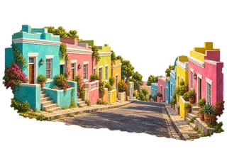
Bo-Kaap streetscape study
Bright plaster fronts step down a street in Cape Town's Bo-Kaap.
Source: City of Cape Town
Southern Africa
Discover Bo-Kaap streetscape study, Boulders African penguins - habitat study, Bourke's Luck Potholes and more.
Explore 12 illustrated places, read the stories behind them and look closer on the globe.
Explore South Africa on the globe →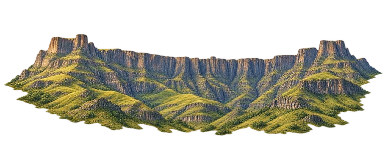
culture
Bright plaster fronts step down a street in Cape Town's Bo-Kaap.
Source: City of Cape Town
wildlife
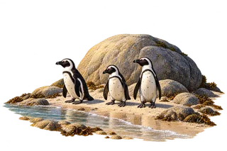
Black-and-white African penguins stand beside rounded granite and pale sand.
Source: SANParks
geology
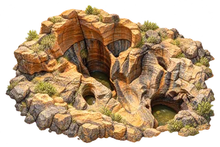
Near the meeting of the Blyde and Treur rivers, long erosion has carved rounded potholes and channels into the rock. Look into the darker hollows, then follow the curved walls around them. This close study concentrates on those water-shaped forms rather than the whole river confluence.
Source: South African Tourism
architecture
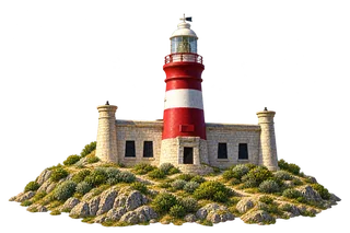
Cape Agulhas Lighthouse first shone in 1849, helping ships navigate a hazardous coastline. Look for the central striped tower and the small round corner turrets of the low stone building. The lighthouse is a landmark near the cape, rather than the exact stone marker at the southernmost point.
Source: SANParks
landscape
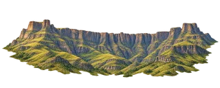
The Amphitheatre is a great rock wall in the northern Drakensberg, within the uKhahlamba-Drakensberg landscape. A long rim curves above deeply ribbed cliff faces, with green foothills below. Look toward the higher buttresses at either end, then follow the wall between them. Its name recalls the shape of an open theatre, although the rock wall was formed by natural processes.
Source: South African Tourism
wildlife
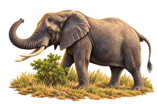
An African elephant's ears help it lose heat, while its versatile trunk can grasp vegetation and handle water. Letaba is a Kruger National Park locality associated with learning about elephants through its Elephant Hall. This wildlife study represents habitat and species, not a promise that a particular elephant will be at one map point.
Source: SANParks
history
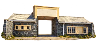
This gateway belongs to the Visitors' Amenities Building, which connected visitors and prisoners during the island's prison era. It is at the harbour, not the entrance to the inland maximum-security cell blocks. Its stone walls and roadway opening are part of a difficult history of imprisonment and controlled contact under apartheid.
Source: Robben Island Museum
landscape
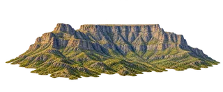
Table Mountain's long upper edge is very different from a pointed Alpine summit. Follow its steep rock faces down into the green lower slopes. The mountain forms part of Table Mountain National Park, which protects a much wider landscape than this one painted massif.
Source: SANParks
history
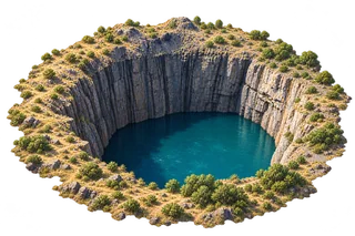
Digging at Kimberley's diamond mine began in 1871 and ended in 1914. The remaining excavation is known as the Big Hole. Its dark walls and water-filled depths record mining activity, so it should not be mistaken for a volcanic or meteorite crater.
Source: The Big Hole Museum
geology
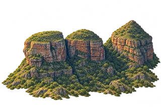
The Three Rondavels are well-known rock formations above the Blyde, or Motlatse, Canyon. Rounded green caps rise above steep, banded rock sides. Look at how the three tops differ: two are more rounded, while another rises to a sharper cap. Their name compares the formations to the shape of traditional round houses. The surrounding canyon adds a much larger landscape beyond the named trio.
Source: South African Tourism
architecture
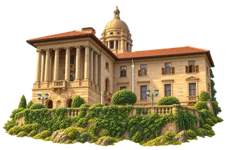
Designed by Herbert Baker and completed in 1913, the Union Buildings are a seat of South Africa's government. They also hosted Nelson Mandela's presidential inauguration in 1994. This study concentrates on one domed-tower wing, rather than pretending to show the whole curved building and gardens.
Source: The Presidency of South Africa
geology
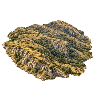
Vredefort Dome preserves part of a huge meteorite impact structure formed about two billion years ago. Erosion has removed much of the original crater, exposing evidence from beneath its floor. These rocks help scientists investigate both the impact and the deeper geological history of the Earth.
Source: UNESCO World Heritage Centre
Read more about South Africa · Choose another country or territory · How to play USURPR